Madden-Julian Oscillation: The bearer of tropical rain
After a long wait the rain is finally falling up north and it is thanks to the Madden-Julian Oscillation (MJO).
Key points:
The Madden-Julian Oscillation is moving over northern Australia, encouraging wet conditions
The climate driver usually takes between a month and 60 days to make its way around the tropics
Although this MJO is weak with the La Niña active, it opens the door for rain and storms in the coming weeks
But before we go giving the MJO too much praise, this fickle climate driver has also been behind keeping things dry over the past few weeks.
So, what is the MJO?
Claire Vincent from the ARC Centre of Excellence for Climate Extremes says the MJO is a large area of cloudiness and storms that moves around the tropics from the Indian Ocean.
“It moves eastwards at about five metres per second, so spending around five days in each location as it moves over,” she said.
It usually takes between 30 and 60 days for the MJO to move from where it forms in the Indian Ocean, across the Maritime Continent (a term meteorologists use to describe Indonesia, the Philippines and Papua New Guinea) and the Pacific before it dies out over South America.

On the ground, it often leads to several days of enhanced lift, cloudiness, storms and rainfall.
It is felt most strongly during the summer when Earth is tilted, so those moist tropical systems trace right across northern Australia where they play a big part in the onset and bursts of the monsoon.
“Interestingly, it also does have links with the mid-latitudes. There are signals of enhanced rainfall in the southern part of Australia,” Dr Vincent said.
But the impacts down south are small compared to those in the tropics.
What goes up, must come down
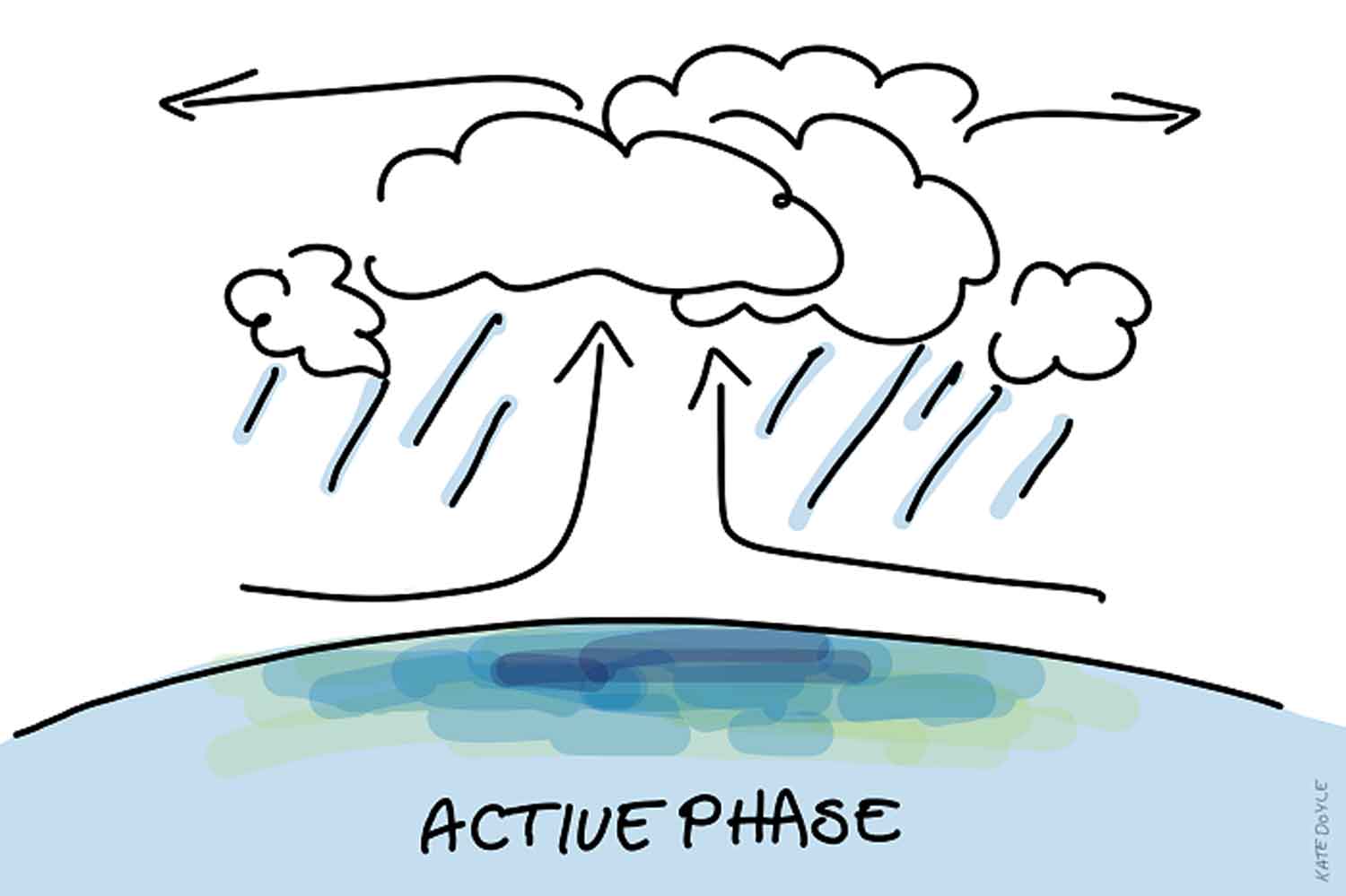
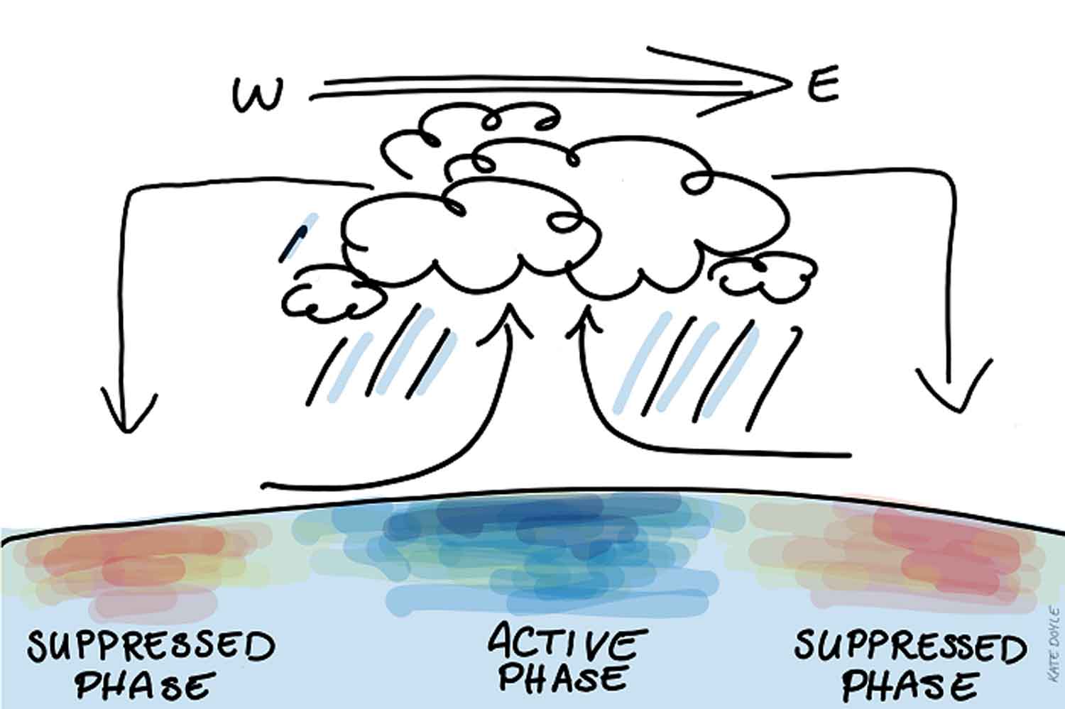
There is large upward motion in the active phase of the MJO, causing storms, convection and all that glorious rain — but all the lifted air has to go somewhere.

Before and after the active phase come the suppressed phases of the MJO, when large-scale downward motion in the atmosphere prevents lift and helps keep things dry.
Over the past few weeks this downward motion has blocked the lift and rainfall we would usually expect with La Niña conditions for northern and eastern Australia, helping to keep things hot and dry.
How does the MJO mingle?
As we have seen this year, the MJO can block or enhance the effects of the La Niña in the western Pacific.
Another way it can affect the Pacific circulations is by kickstarting La Niña’s opposite form, El Niño.
Matthew Wheeler, principal research scientist at the Bureau of Meteorology, said research had shown that strong MJO events in March, April or May could encourage a downwelling in the thermocline in the Pacific Ocean, eventually resulting in warm waters in the eastern Pacific, triggering an El Niño.
Keeping track of the MJO
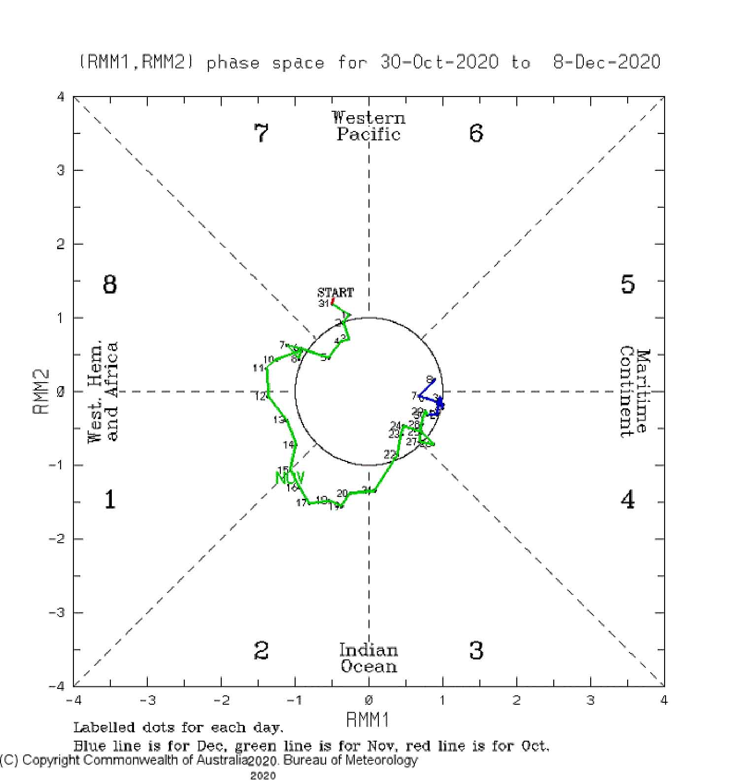
Meteorologists keep track of the MJO using what is called a phase diagram, which marks the daily location and strength of the active MJO phase.
Each section of the diagram represents a geographical region — the further the dot is from the centre, the stronger the MJO.
Dr Vincent said the sections over Australia were mainly five and six and, to some extent, seven.

The diagram shows the MJO was quite active during November, when it was causing air to rise over the Indian Ocean but descend on Australia.
“That was part of the reason why our seasonal forecast … was going for a wet northern Australia but November ended up being relatively dry in many locations across the north,” Dr Wheeler said.
The MJO has weakened as it moved east.
The active phase is just moving over northern Australia, and even though it is quite weak, it should at least no longer be blocking the La Niña from helping bring wetter conditions.
“Right now, even though it’s borderline weak/strong, it’s more favourable now for letting the wet season get under way again in northern Australia,” Dr Wheeler said.
The BOM’s outlook for summer suggests there is still a high likelihood of above-average rainfall for much of the country.


